 |
Hempstead |
|
Village History |
||||||||||||
|
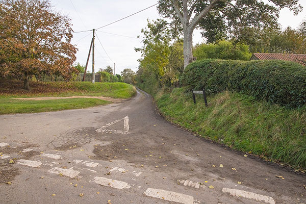 |
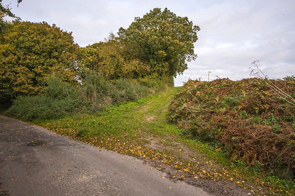
Chapel Lane junction with The Street - 6th November 2021
|
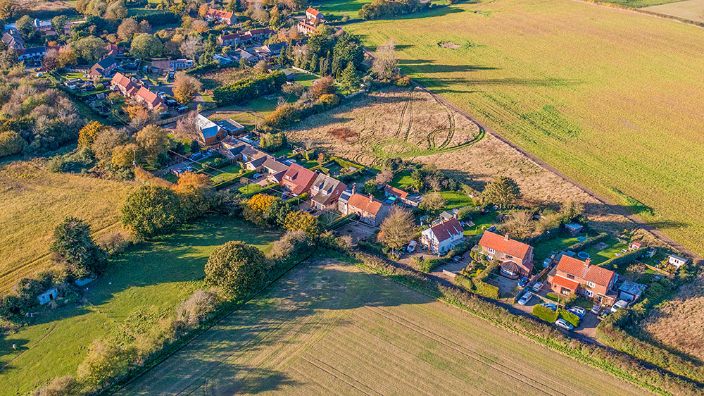
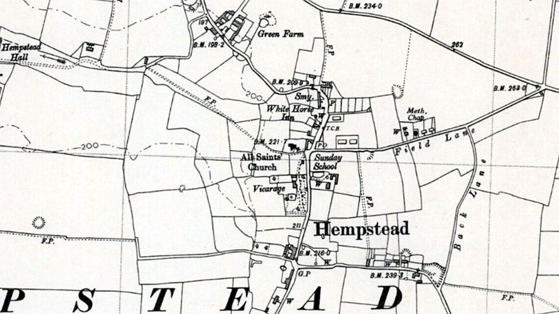
Chapel Lanes runs from the Baconsthorpe - Holt Road in the east to its western junction with The Street in the middle of the village. |
| Back Lane, which is now no more than a farm track runs south to connect Chapel Lane with Marlpit Lane. |
| The 1885 O.S. map shows that there was just a single property with a well on Field Lane at that time. However, the 1891 census lists a single property as being in Paper Lane - between the Vicarage and Holt Road. |
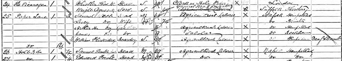 Census 1891 Census 1891 |
| During 1895-96, a Weslyan Chapel capable of seating 100 persons was built adjacent and just to the east. |
| Directories list a Weslyan Chapel until 1933, when a Methodist Chapel is listed. The O.S. maps of 1905 and 1950 both show a Methodist Chapel. However, another 1905 O.S. map shows the chapel labelled with both denominations. |
| The Weslyan chapel, built in 1895-6, is of local stone and red brick, and will seat 100 persons. Kelly's 1929 |
| The Methodist chapel, built in 1895-6, is of local stone and red brick, and will seat 100 persons. Kelly's 1933 |
On the O.S. map of 1950, Field Lane is marked showing the buildings on its north side, consisting of three cottages, the chapel and two blocks of council houses. It wasn't until the early 1970s that the main development of new houses took place when five plots of building land were put up for sale. |
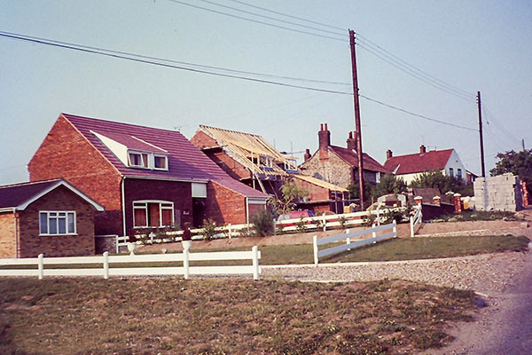
Chapel Lane leads away from The Street in the heart of the village in a gentle incline to eventually link up with the Holt-to-Baconsthorpe road. Five plots of land fronting Chapel Lane were sold through John Shrive’s Estate Agency in the early 1970’s. The first three plots nearest to the village each had bungalows, a local electrician (Malcolm Power) had the fourth to build a substantial house, and we purchased the last, smallest odd-shaped plot in 1975. The plot cost less than £2000 and we designed, project managed and built our house during the hot summer of 1976. Naming the house ‘Thistledown’ from the original appearance of the totally overgrown site, it was cleared and levelled by Bob Mack who lived on Court Green. Following a great deal of kindness and hands-on carpentry work from Fred Power, a near neighbour living in Chapel Lane, we moved from Holt to ‘Thistledown’ in April 1977. The Post_Office was run by Laura Bacon and closed the following year. |
 |
|
Plot 5, later to become Thistledown being cleared by Bob Mack of Court Green - 1976 |
Thistledown under construction in Plot 5, Chapel Lane - 1976 |
 |
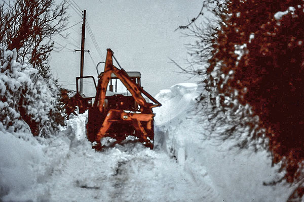 |
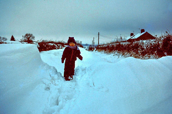
Chapel Lane blocked by snow - January 1982 |
Snow clearing in Chapel Lane - January 1982 |
 |
 |
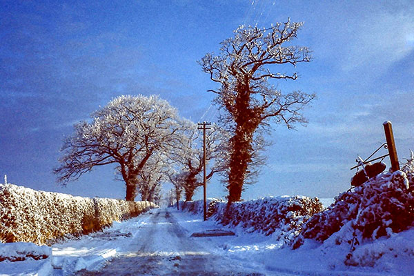
Chapel Lane looking towards the Baconsthorpe Road - January 1982 |
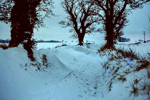
Back Lane north junction looking south towards Marlpit Lane - January 1982 |
 |
 |
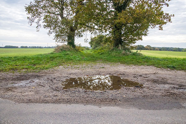
Back Lane north junction looking south towards Marlpit Lane - 8th November 2021 |
Back Lane south junction looking north towards Chapel Lane - 6th November 2021 |
 |
 |
Back Lane - 25th December 2020 |
Back Lane - 9th November 2021 |
 |
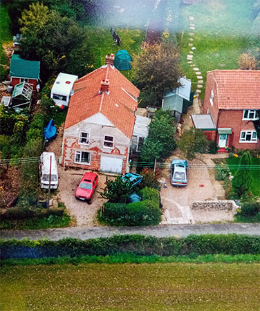
The Chapel - June 1986 |
Myself, Fred Power
and Gladys in the next door garden wondering why there was a plane
circling above! |
 |
The Chapel - October 1999 |
c.1948, the congregation having dwindled to a very small number, the Methodist Circuit sold the roof timbers and window frames and furniture for use in a new Memorial Chapel in Beeston Regis. A well was sunk and the remains of the building converted into a cottage known as 'Hill House'. After it became a dwelling, it was used as an holiday home by an American family, then family named Slade (said to have connection to Trade Union - may have been a Sir) - then Dr McCloud from Holt Surgery. |
The Old Methodist Chapel, home of Robert Wattis and family is put up for sale - during the summer they were visited by members of an American family who had lived there in 1956/57. Mrs Irene Sheets had lived there with her husband Ray who had been a doctor at the USAF Base at Sculthorpe. The house was the only available house in the village at that time that had running water. Her daughter Barbara was born in Norfolk and is now a doctor herself in North Dakota, USA. |
Previous residents of the old chapel were - |
 |
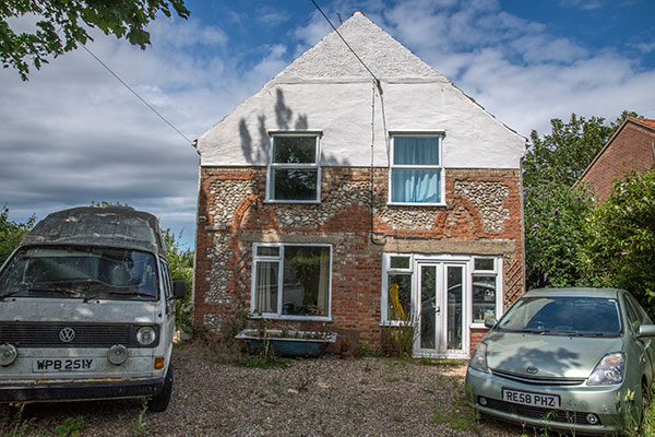 |
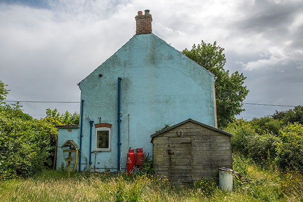
The Chapel rear - 6th July 2020 |
The Chapel - 6th July 2020 |
 |
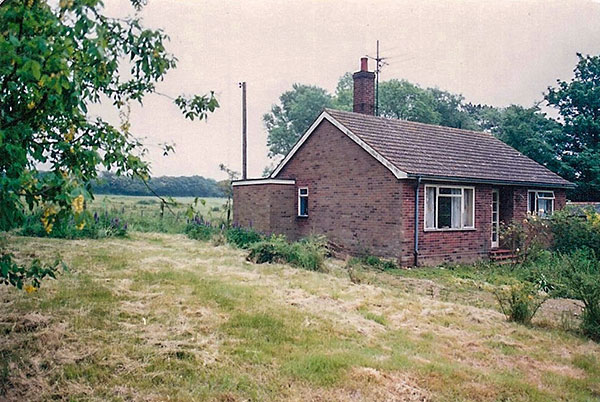 |
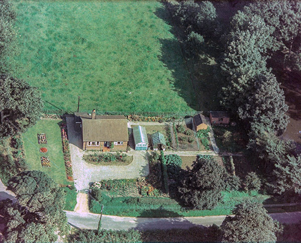
Lodge Bungalow - 1971 |
Lodge Bungalow - c.1992 |
Lodge Bungalow stands on southern the corner of The Street and Chapel Lane |
|
 |
Chapel Lane - 9th November 2021 |
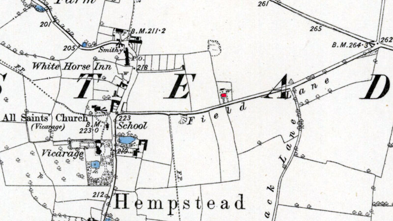 |
O. S. Map 1885 Field Lane is marked showing a single cottage with its own well Courtesy of NLS map images |
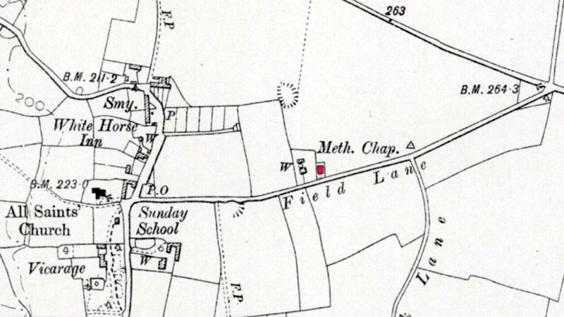 |
O. S. Map 1905 Field Lane is marked showing a cottage and the chapel Courtesy of NLS map images |
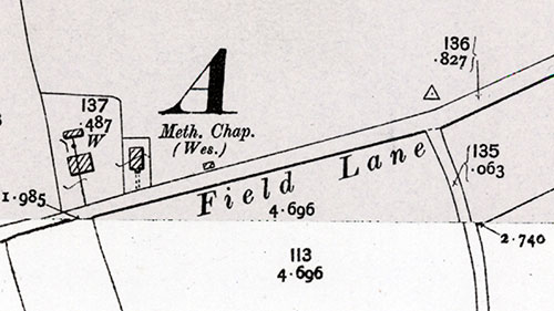 |
O. S. Map 1905 Courtesy of NLS map images |
 |
O. S. Map 1950 Field Lane is marked showing three cottages, the Methodist Chapel and two blocks of council houses Courtesy of NLS map images |
If you have any memories, anecdotes or photos please let us know and we may be able to use them to update the site. Please
or telephone 07836 675369 |
Website copyright © Jonathan Neville 2021 |